|
Size: 3524
Comment:
|
Size: 3532
Comment:
|
| Deletions are marked like this. | Additions are marked like this. |
| Line 45: | Line 45: |
| script |
Test F3H - Latitude
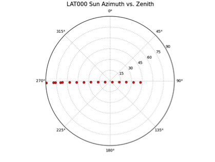
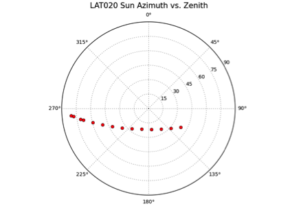
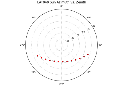
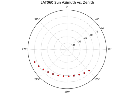
Goal: Physical characteristics of the object. The maximum variation in sub-solar position is a function of the latitude of the TAG site. The higher in latitude the TAG site is, the lower quality the variations in Sun vector. Thus, we can get a better idea about how big this error is as we move to the polar regions.
Test Set Up
Data: Detailed Survey.
Start: 75cm Preliminary Survey Shape Model.
Build: Build TAG Site 1 for each Sub-Test, but using different images than standard. Because the shape model has different topography, we would not be able to build a TAG Site at each latitude and compare results -- RMS is strongly effected by variations in topography. As such, we will adjust the position of the Sun so that the images match the observing/illumination conditions that DS would have if TAG Site 1 was at different latitudes.
Sub-Test F3H-1 to F3H-9
For each Sub-Test, we start with the Preliminary Survey Shape Model. We build the topography using the Detailed Survey Images that are available at each latitude. Images will need to be generated with Bennu with the Sun position that cannot really exist. Either Bennu can be inclined by the needed number of degrees with the pole and date matching the summer solstist, or the SPOC has tools to generate images and SUMFILES for specific illumination geometries. The SPOC has conducted similar variations in illumination parameters so this is well understood. For this test, the SPOC would use Imager_MG to generate the images, which generated almost all of the images needed for Test F2-Calibration. The Test Engineer has compared the output of Freespace and Imager_MG and has determined that the variations between the two systems are not significant.
Details for Sub-Test F3H-1 to F3H-9:
Sub-Test |
Latitude |
Number of Images |
Emission Range |
Incidence Range |
F3H-1 |
0° |
TBD |
TBD |
TBD |
F3H-2 |
-8° |
TBD |
TBD |
TBD |
F3H-3 |
-20° |
TBD |
TBD |
TBD |
F3H-4 |
-30° |
TBD |
TBD |
TBD |
F3H-5 |
-40° |
TBD |
TBD |
TBD |
F3H-6 |
-50° |
TBD |
TBD |
TBD |
F3H-7 |
-60° |
TBD |
TBD |
TBD |
F3H-8 |
-70° |
TBD |
TBD |
TBD |
F3H-9 |
-80° |
TBD |
TBD |
TBD |
Evaluate:
- Relative Accuracy. Create truth models for each of the latitude TAG sties. Then compute the RMS deviation between the truth and the model.
Examples:


Directory Setup
Run from the F3H-Lat directory
0. Start typescript
script
date
pwd
ls -l
1. Create Sub-Test directory
rsync --delete -ha orig/ test/
2. Add Sub-Test images
/SPC_Test/F3H-Lat/base/IMAGEFILES/ should already have all the images. We will control the images used by SPC via PICTLIST.TXT
Should also set up a PICTLIST.TXT for each sub-test and put it in lsupport/
2.1 User Input
testID=F3H-X
2.2 Copy and/or link files
cp registered_images/$testID/NOMINALS/* test/NOMINALS/
ls -l test/NOMINALS
cp registered_images/$testID/SUMFILES/* test/SUMFILES/
ls -l test/SUMFILES
rm PICTLIST.TXT
ln -s test/lsupport/PICTLIST_$testID.TXT PICTLIST.TXT
cat PICTLIST.TXT
3. Tile at 20cm
cat support/TILE20.in
ls -l /usr/local/bin/bigmap
/usr/local/bin/bigmap < support/TILE20.in | tee log-TILE20
echo "TILE20" | showmap
convert TILE20.pgm TILE20.jpg
cp TILE20.jpg ~/send/

MORE
