Test 10: UltraFeatureF2
Purpose of test: To obtain highest possible topographic accuracy and resolution for features such as 2m wide boulders and craters, given perfect camera position and pointing and optimal SPC image suite.
- Subtest of not holding old landmarks when doing the next tiling step (Diane)
- All
Data
- Data was generated by Imager_mg using shape3.8 on ormacsrv1.
- PT10A - Centered at the middle of TAG site one.
- Image resolution is a little over 1cm, taking roughly at 800m from center of surface (correct).
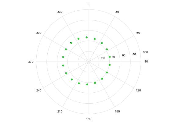
- emission
- Every 20 degrees azimuth, 45 zenith angle
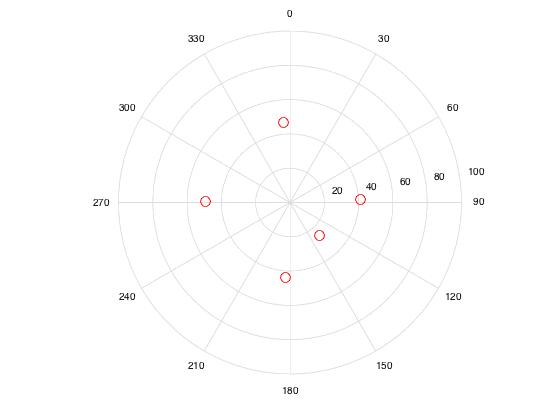
- incidence
- 0, 90, 180, 270, 45 zenith angle
- 135 azimuth, 30 zenith angle
Spacecraft:

Sun:

- PT10B, PT10C, PT10D, PT10E, PT10F, matches Lockheed Features 1-5 respectively.
- Lockheed features were the suite from October. We used the ones from the TAG site.
- Image resolution is 0.25cm.
Five features have been identified in TAG site 1. For each feature the following bigmaps will be tiled and evaluated:
Test Step |
Bigmap Resolution |
Tiling Resolution |
Ground Sample Distance |
Bigmap Width |
Q size |
Tiling |
2cm |
1.5cm |
N/A |
2.5m |
85 |
Tiling |
1cm |
0.8cm |
N/A |
2.5m |
160 |
Tiling |
0.5cm |
0.4cm |
N/A |
2.5m |
315 |
Evaluation |
N/A |
N/A |
0.5cm |
2m |
200 |
Lockheed Features -- Oct 2015
- MMAPL1 -9.203 262.089 - Diane
- MMAPL2 -6.500 263.519 - Kris
- MMAPL3 -7.683 261.658
- MMAPL4 -8.054 263.091 - Eric
- MMAPL5 -8.858 263.551 - John
Evaluation
- TEV-L1 (1-5). Q=320, Res=0.5cm. In the truth directory as "obj" files. Slightly bigger than the bitmap so we can do CompareOBJ. Reference T15-1K
- TLOCK1 (1-5). Q=300, Res=0.5cm. In the truth directory as MAP files. Use for flatMapVec and compMapVec. Reference T15-1K
