|
Size: 3998
Comment:
|
Size: 3996
Comment:
|
| Deletions are marked like this. | Additions are marked like this. |
| Line 10: | Line 10: |
| == Example display: == | = Example display: = |
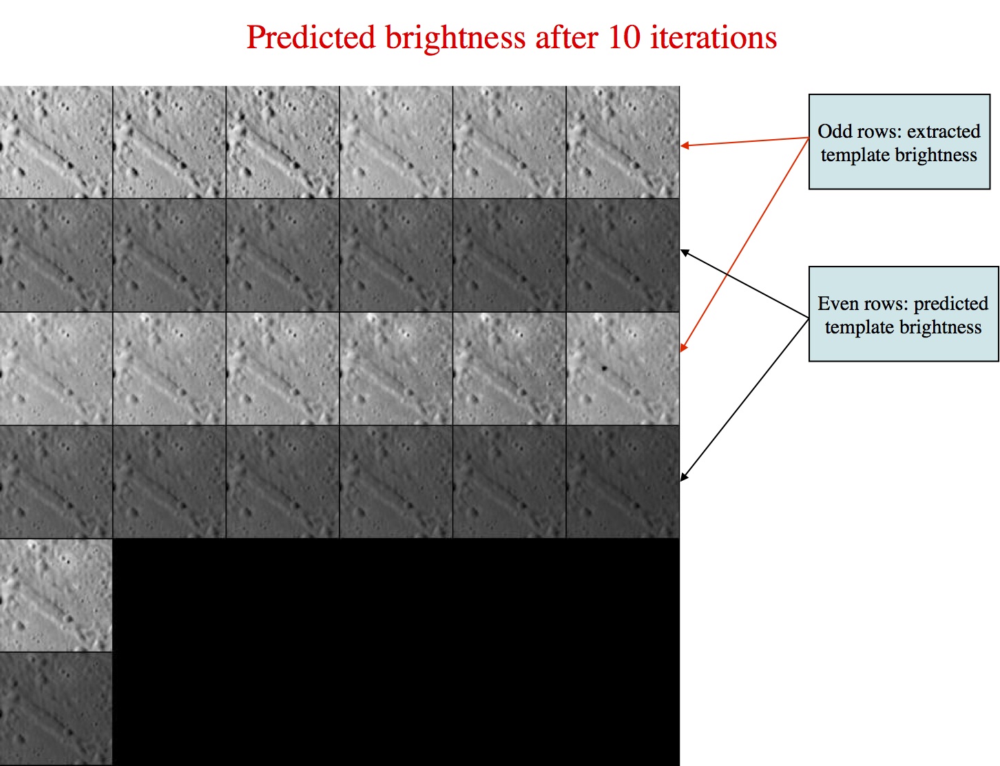
This option will build a template that can be used to further align images. The template to which we are referring can be seen in the below image. In this image the odd rows are referred to as "extracted templates" because they are derived from the spacecraft pictures, but have been modified (orthorectificed plus other alterations). The even rows are referred to as "predicted templates" because they are derived from the maplet. Many people (including this author) will refer to a "predicted template" as just simply the "template", and the "extracted template" as "images." The template is the digital representation of the topography that is illuminated under the same conditions as the image immediately above the template found in each row.

SPC uses a template for aligning images using Align landmarks, and also adds image data to the template prior to building topogography (the last term is also known as Find Heights). First you select images to work with. Frequently all are on by default, but if you have a difficult image, you can toggle it off.
Example display:
Main Menu: Q 0123O IUCRSG NVAMBX DEPL FZH? 0
 >0

EE0001
Lat =    -6.819
Lon =   264.131
Rad =     0.266

    k    chi    lambda   phi     res

    1   0.975   1.162   0.000   0.250
    2   0.962   1.138   0.000   0.250
    3   0.950   1.373   0.000   0.260
    4   0.967   1.063   0.000   0.260
    5   0.964   1.066   0.000   0.261
    6   0.939   1.378   0.000   0.253
    7   0.955   1.060   0.000   0.253
    8   0.978   1.166   0.000   0.242
    9   0.961   1.134   0.000   0.242
   10   0.980   1.108   0.000   0.234
   11   0.940   1.361   0.000   0.234
   12   0.975   1.091   0.000   0.233
   13   0.975   1.100   0.000   0.239
   14   0.000   1.348   0.000   0.239
Example broken down:
EE0001 - Landmark name
Lat = -6.819 - Latitude
Lon = 264.131 - Longitude
Rad = 0.266 - Radius from center of figure
k - Image number
Chi - ???
lambda - ???
phi - ???
res - The ratio of image resolution to maplet resolution. Larger numbers means the image has a lower resolution than the maplet. Typically, we don't use much greater than 4.
Options
 Picture to toggle
 a use all
 b use registered
 c use correlated
 0 end/continue
 q Quit
a use all - Includes all of the images in calculation of the template (i.e. removes the * from all images)
b use registered - ???
c use correlated - Prompts you to enter a number between 0-1. Compares the number you entered with the correlations from the last alignment performed. Excludes images below the entered value.
0 end/continue - Begins template iterations
Enter number of iterations - Enter in the number of iterations to perform when building the template. Usually enter in 40. After the iterations are finished it will bring you back to the Main Menu.
q Quit - go back to the Main Menu
Hidden Option
# Image number - Instead of entering "a, b, c, etc." you can also just enter in the image number (ex. 2, then "Enter"). If you type an image number, it will toggle the "selected" flag (*)
#, # - Similar to above, but a range of images. It will toggle the "selected" flag (*) for all images within that range
Typical Use
- First starting, using 0, c, 0.5
- this does......
- Typical iterations, using 0, 0, 40
- this does.....
Example output from typical use. picture of before
jksa dfj
0
0
40
Run run run
(snip to make shorter)
picture of after
When you run, you look for this....
