|
Size: 2573
Comment:
|
Size: 2577
Comment:
|
| Deletions are marked like this. | Additions are marked like this. |
| Line 14: | Line 14: |
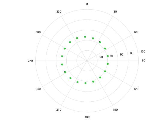
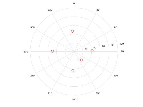
| * Image resolution is a little over 1cm, taking roughly at 800m from center of surface (correct). * emission * Every 20 degrees azimuth, 45 zenith angle * incidence * 0, 90, 180, 270, 45 zenith angle * 135 azimuth, 30 zenith angle |
* Image resolution is a little over 1cm, taken at approx. 800m from center of surface (correct). * Emission: * Every 20 degrees azimuth, 45 zenith angle. * Incidence: * 0, 90, 180, 270, 45 zenith angle. * 135 azimuth, 30 zenith angle. |
Test 10: UltraFeatureF2
Purpose of test: To obtain highest possible topographic accuracy and resolution for features such as 2m wide boulders and craters, given perfect camera position and pointing and optimal SPC image suite.
Additional Technique Testing - DTM Evaluation Based on Highest Resolution Maplets Only
In the standard SPC procedure, lower resolution maplets from earlier processing steps are included in evaluation bigmaps. Information from the highest resolution maplets is therefore conditioned with low resolution data. Theoretically, the accuracy of the DTM would increase if the topography was generated using only the highest resolution maplets.
A subtest was conducted on Lockheed Feature 1 to investigate the effect of only included the highest resolution maplets in the evaluation bigmap.
Data
- Data was generated by Imager_mg using shape3.8 on ormacsrv1.
- PT10A - Centered at the middle of TAG site one.
- Image resolution is a little over 1cm, taken at approx. 800m from center of surface (correct).
- Emission:
- Every 20 degrees azimuth, 45 zenith angle.
- Incidence:
- 0, 90, 180, 270, 45 zenith angle.
- 135 azimuth, 30 zenith angle.
Spacecraft:

Sun:

- PT10B, PT10C, PT10D, PT10E, PT10F, matches Lockheed Features 1-5 respectively.
- Lockheed features were the suite from October. We used the ones from the TAG site.
- Image resolution is 0.25cm.
Five features have been identified in TAG site 1. For each feature the following bigmaps will be tiled and evaluated:
Test Step |
Bigmap Resolution |
Tiling Resolution |
Ground Sample Distance |
Bigmap Width |
Q size |
Tiling |
2cm |
1.5cm |
N/A |
2.5m |
85 |
Tiling |
1cm |
0.8cm |
N/A |
2.5m |
160 |
Tiling |
0.5cm |
0.4cm |
N/A |
2.5m |
315 |
Evaluation |
N/A |
N/A |
0.5cm |
2m |
200 |
Lockheed Features -- Oct 2015
MMAPL1 -9.203 262.089 - Diane
MMAPL2 -6.500 263.519 - Kris
MMAPL3 -7.683 261.658
MMAPL4 -8.054 263.091 - Eric
MMAPL5 -8.858 263.551 - John
Evaluation
- TEV-L1 (1-5). Q=320, Res=0.5cm. In the truth directory as "obj" files. Slightly bigger than the bitmap so we can do CompareOBJ. Reference T15-1K
- TLOCK1 (1-5). Q=300, Res=0.5cm. In the truth directory as MAP files. Use for flatMapVec and compMapVec. Reference T15-1K
