bigmap
Category B |
Version 3.0 |
Description
This procedure creates a large topographical/albedo map with the same file structure as a maplet.
The location of the map center is specified by one of three choices:
p - pixel/line location in a picture
l - latitude and west longitude
m - pixel line location in a bigmap or maplet
A second set of inputs contains:
- the bigmap scale in km/px
- the half-size (qsz)
- an integer random seed
- a maximum maplet scale in case lower resolution maplets are to be excluded
The program first determines the body-fixed vector to the map center and the approximate surface normal vector (Uz). It then projects the shape model onto this surface and determines a second approximation of Uz by fitting a plane to the heights. It repeats this process one more time. The new map coordinate frame is then oriented so that East is to the right.
The program checks to see if any these files exist:
- BIGMAP.IN
- LMRKLISTR.TXT
- LMRKLIST.TXT
It takes the maplets to be used from the first of these files that it finds.
If you include the line 'LMKLX=.TRUE.' in INIT_LITHOS.TXT, bigmap will read LMRKLISTX.TXT. This will speed up the program by determining which maplets will be used without opening their .LMK files.
The bigmap reference plane has (2*qsz+1)^2 points at locations:
p(i,j) = V + j*Ux +i*Uy (i,j = -qsz,qsz)
A line from each of these points in the normal (Uz) direction will pierce a number of maplets. For each i,j the program keeps track of:
- the weighted accumulation of the heights to the piercing points
- the squares of those heights
- the slopes and albedos of the maplets at the piercing points
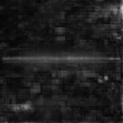
Once these arrays are filled, bigmap computes the average heights and albedos at each point of the reference plane, as well as the standard deviation of the heights. This provides a convenient measure of the height uncertainty at each point. Displaying SIGMAS.pgm provides a quick means of identifying possible problem areas, as depicted in Figure 00.
Required Files
LMKFILES/ - Directory of .LMK files for each maplet.
LMRKLIST.TXT - Required. List of landmarks.
MAPFILES/ - Directory of .MAP files.
SHAPEFILES/ - Directory of built shapes.
BIGFILES/ - Directory of .LMK files for each of the required bigmaps. This directory must be created, but changes are made within.
SUMFILES/ - Info about the maplets.
 Many files must be unique. All directories can be linked to a master.
Optional Files
BIGMAP.IN - A list of landmarks that you want to use for bigmap. This file allows you to reduce the number of files and avoid low resolution maps.
LMRKLIST.TXT - This also restricts the list of LANDMARKS, but this is used by more programs than just BIGMAP.
 If neither of these files exists, the program will build the list of LANDMARKS based on the coverage.
Output Files
INSIDE.TXT - The maplets that fall completely within the planned bigmap. Created by bigmap.
USED_MAPS.TXT - All the maps used to create the bigmap.
BIGLIST.TXT - List of needed mapfiles (bigmaps) used to construct the working bigmap.
USED_PICS.TXT - List of all pictures used in the creation of most recent bigmap.
- bigmap - The name is based on the input (e.g., ZN0208.IN).
- slope.pgm - Image that shows the slope in both horizontal and vertical. This is useful for debugging and to provide a general idea of how the landmark is developing.
SIGMAS.TXT - Each time BIGMAP is run, it adds a line to this file showing the current sigma values.
- SIGMAS.pgm - Graphically shows the highest level of error (sigma) for maplets (see Figure 00).
Using bigmap
The input for bigmap consists of a long set of commands that are usually contained within a file.
 Longitude is in west longitude. You must use a negative to match what is used in spheremapB.
  The location of bigmap depends on your server. The default location is /usr/local/bin
Here is a sample input for bigmap:
~/bin/bigmap < ZN0208.IN
The following sample shows the normal format for the input file with some explanatory comments.
l   (select location, 1 is lat/lon)
    20    -40    (latitude, west longitude)
   0.06250       500   1.23400   1000  (scale, qsz (number of pixels), seed, max maplet res)
ZN0208           (filename)
1                (end or integrate, 1 is integrate) <--- here begins the slope to heights integration
.005             (input fraction)                   <--- fraction of points as seed heights in slope to height integration
.025             (input weight)
1                (end, continue, or change weight, 1 is continue integrating)
1                (end, continue, or change weight, 1 is continue integrating)
1                (end, continue, or change weight, 1 is continue integrating)
1                (end, continue, or change weight, 1 is continue integrating)
1                (end, continue, or change weight, 1 is continue integrating)
1                (end, continue, or change weight, 1 is continue integrating)
1                (end, continue, or change weight, 1 is continue integrating)
0                (end, continue, or change weight, 0 is end iteration)
0                (no, square, or round template, 0 is No Template)
Here is a sample of sigmas.pgm:

Figure 00: Output of SIGMAS Graphical Format
(Compiled by TC)
