|
Size: 1220
Comment:
|
← Revision 12 as of 2018-05-05 21:21:10 ⇥
Size: 1246
Comment:
|
| Deletions are marked like this. | Additions are marked like this. |
| Line 2: | Line 2: |
| This code was developed for the Mercator Project (LASER Program). The code uses Gaskell's basic infrastructure and data files. |
|
| Line 9: | Line 7: |
| The program takes a bigmap and will generate a surface image as if you are standing on (or near) the surface. It is designed to have a 100mm focal length lens and generate a 1024x1024 image. | . (!) This code was developed for the Mercator Project (LASER Program). The code uses Gaskell's basic infrastructure and data files. == Description == '''surface_imager''' takes a [[bigmap]] and generates a surface image as if you are standing on (or near) the surface. It is designed to have a 100mm focal length lens and generate a 1024x1024 image. |
| Line 12: | Line 13: |
| === Input - files === | == Input Files == |
| Line 15: | Line 16: |
| === Input - stdin === | == Input stdin == |
| Line 17: | Line 18: |
| * Location of the point of view (x, y, z). X and Y are pixel position within the map. Z is in meters above the surface. | * Location of the point of view (x, y, z). X and Y are pixel positions within the map. Z is in meters above the surface. |
| Line 19: | Line 20: |
| * Sun position (azimuth and elevation (azimuth and elevation - in degrees). Zero azimuth has the Sun due north. 90 elevation is the Sun straight up. | * Sun position (azimuth and elevation - in degrees). Zero azimuth has the Sun due north. 90 elevation is the Sun straight up. |
| Line 21: | Line 22: |
| Here's a sample input: | |
| Line 22: | Line 24: |
| {{{Example | {{{ |
| Line 30: | Line 32: |
| === Output === | == Output == |
| Line 35: | Line 37: |
| ---- | ---------- |
surface_imager
Category ? |
Version ? |
 This code was developed for the Mercator Project (LASER Program). The code uses Gaskell's basic infrastructure and data files.
Description
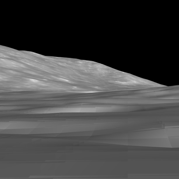
surface_imager takes a bigmap and generates a surface image as if you are standing on (or near) the surface. It is designed to have a 100mm focal length lens and generate a 1024x1024 image.
Input Files
- none
Input stdin
- Bigmap name
- Location of the point of view (x, y, z). X and Y are pixel positions within the map. Z is in meters above the surface.
- Direction that you are looking (azimuth and elevation - in degrees). Zero azimuth is looking due north. Zero elevation is looking at the horizon.
- Sun position (azimuth and elevation - in degrees). Zero azimuth has the Sun due north. 90 elevation is the Sun straight up.
Here's a sample input:
123456
1733 1393 10
90, 0
60, 30            <- low sun angle
Output
- IMAGE.pgm - The output image. Normally, it is 1024x1024 of the field of view (about 24 degrees square).

