|
Size: 9
Comment:
|
Size: 2044
Comment:
|
| Deletions are marked like this. | Additions are marked like this. |
| Line 1: | Line 1: |
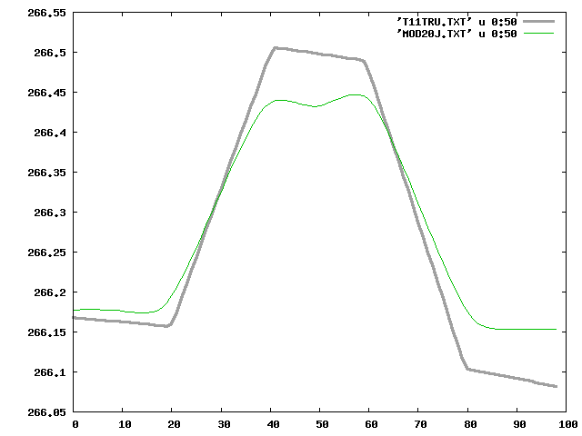
| Test11J | =Test11J:= Building topography with s/c azimuth every 90deg and 5cm images. =Results Summary:= After 10 or so iterations the maplet isn't changing much. The RMS continues to improve, mostly due to vertical displacement, but the representation of the boulder hasn't really changed much. Also note that at step07 I also did a global shift since the center had wandered, which also improved the RMS. RMS values: ||Name ||CompareOBJ(km) ||CompMapVec(m) ||Notes || ||step01 ||2.209835378632664E-4 ||0.20690918 ||aligned by hand || ||step02 ||2.0143047188757188E-4 ||0.18771362 || ||step03 ||1.8558531494299336E-4 ||0.17254639 || ||step05 ||1.631007268882834E-4 ||0.15335083 || ||step06 ||1.5442675388843122E-4 ||0.14645386 ||autoalign || ||step07 ||1.3048433036285282E-4 ||0.10992432 ||aligned by hand again || ||step08 ||1.2619155776245273E-4 ||0.10601807 || ||step10 ||1.1936819572355717E-4 ||0.10110474 || ||step15 ||1.0638313036840408E-4 ||8.88977051E-02 || ||step20 ||9.796714479057133E-5 ||7.50427246E-02 || ||step25 ||8.970664899918905E-5 ||6.45141602E-02 || ||step30 ||8.599809374058143E-5 ||5.93566895E-02 || ||step40 ||8.135536389470144E-5 ||6.03637695E-02 || ||step41 ||8.112512285576559E-5 ||5.91125488E-02 ||start autoalign || ||step45 ||6.035823367187582E-5 ||2.81982422E-02 || ||step50 ||5.942584280874431E-5 ||2.78930664E-02 || ||step60 ||5.973241185121065E-5 ||3.03039551E-02 || ||step70 ||5.94693109905866E-5 ||2.73437500E-02 ||used x .025 || step01{{attachment:step1.png}} step02{{attachment:step2.png}} step03{{attachment:step3.png}} step05{{attachment:step5.png}} step06{{attachment:step6.png}} step07{{attachment:step7.png}} step08{{attachment:step8.png}} step10{{attachment:step10.png}} step15{{attachment:step15.png}} step20{{attachment:step20.png}} step25{{attachment:step25.png}} step30{{attachment:step30.png}} step40{{attachment:step40.png}} step45{{attachment:step45.png}} step50{{attachment:step50.png}} step60{{attachment:step60.png}} step70{{attachment:step70.png}} |
=Test11J:= Building topography with s/c azimuth every 90deg and 5cm images.
=Results Summary:= After 10 or so iterations the maplet isn't changing much. The RMS continues to improve, mostly due to vertical displacement, but the representation of the boulder hasn't really changed much. Also note that at step07 I also did a global shift since the center had wandered, which also improved the RMS.
RMS values:
Name |
CompareOBJ(km) |
CompMapVec(m) |
Notes |
step01 |
2.209835378632664E-4 |
0.20690918 |
aligned by hand |
step02 |
2.0143047188757188E-4 |
0.18771362 |
|
step03 |
1.8558531494299336E-4 |
0.17254639 |
|
step05 |
1.631007268882834E-4 |
0.15335083 |
|
step06 |
1.5442675388843122E-4 |
0.14645386 |
autoalign |
step07 |
1.3048433036285282E-4 |
0.10992432 |
aligned by hand again |
step08 |
1.2619155776245273E-4 |
0.10601807 |
|
step10 |
1.1936819572355717E-4 |
0.10110474 |
|
step15 |
1.0638313036840408E-4 |
8.88977051E-02 |
|
step20 |
9.796714479057133E-5 |
7.50427246E-02 |
|
step25 |
8.970664899918905E-5 |
6.45141602E-02 |
|
step30 |
8.599809374058143E-5 |
5.93566895E-02 |
|
step40 |
8.135536389470144E-5 |
6.03637695E-02 |
|
step41 |
8.112512285576559E-5 |
5.91125488E-02 |
start autoalign |
step45 |
6.035823367187582E-5 |
2.81982422E-02 |
|
step50 |
5.942584280874431E-5 |
2.78930664E-02 |
|
step60 |
5.973241185121065E-5 |
3.03039551E-02 |
|
step70 |
5.94693109905866E-5 |
2.73437500E-02 |
used x .025 |
step01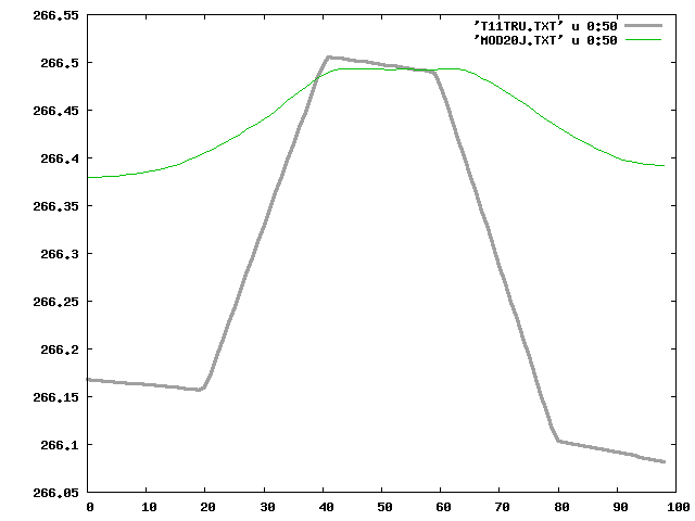 step02
 step03
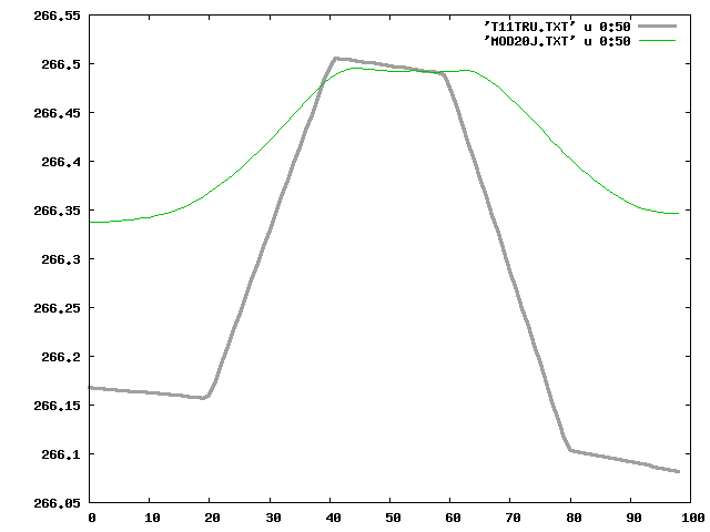 step05
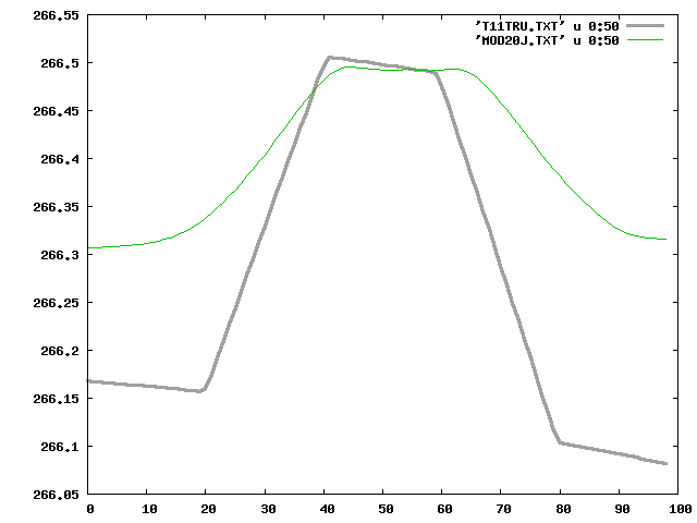 step06
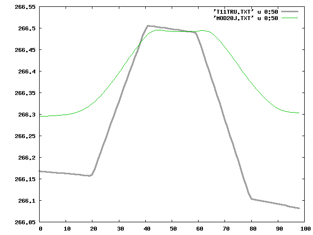 step07
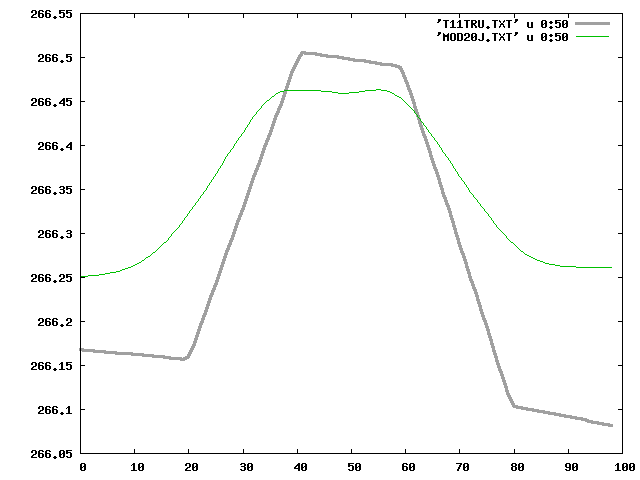 step08
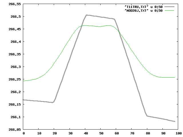 step10
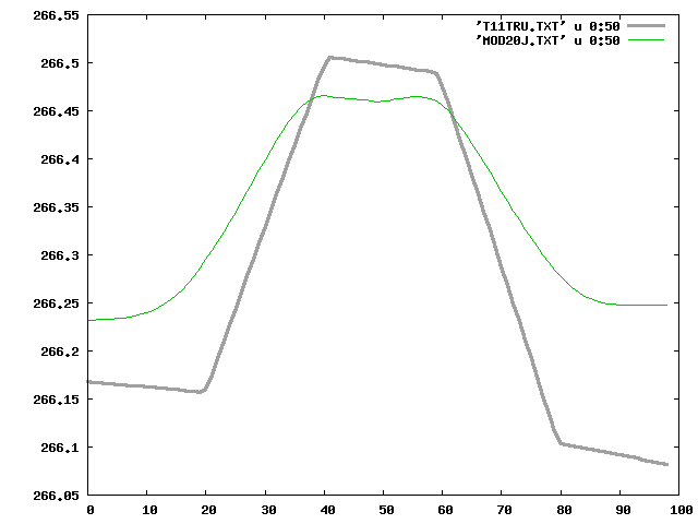 step15
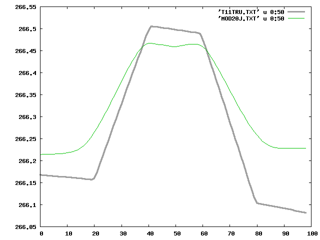 step20
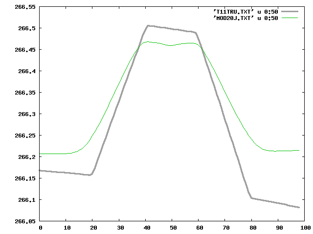 step25
 step30
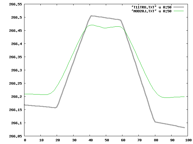 step40
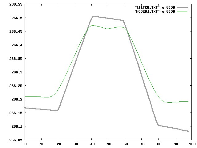 step45
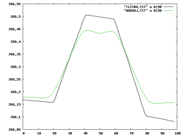 step50
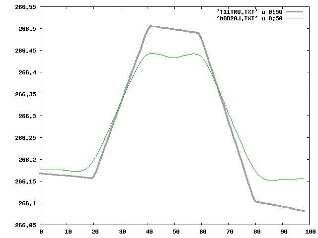 step60
 step70