|
Size: 2513
Comment:
|
Size: 4087
Comment:
|
| Deletions are marked like this. | Additions are marked like this. |
| Line 5: | Line 5: |
| '''Purpose of test:''' To evaluate SPC's ability to represent a simplified 'boulder' which has a constant 20 degree slope. | '''Purpose of Test 11:''' To evaluate SPC's ability to represent a simplified 'boulder' which has a constant 20 degree slope. |
| Line 7: | Line 7: |
| '''Additional Objectives''' * |
'''Objective for Test 11 S, T & U, Spacecraft Zenith Variations''' * To investigate the effect of varying the combination of spacecraft zenith (emission angle) contained in the image suite; * To investigate the effect of the number of images and viewing conditions. |
| Line 12: | Line 13: |
| The 'boulder' was simulated by generating a simple axe-symmetric, flat-topped cone (peak) with a constant 20 degree slope. Two boulder simulations were generated: * A single peak in an otherwise flat landscape of width ?? - Modeled using a single maplet (no overlaps). * Multiple peaks and (simplified) craters in an otherwise flat landscape of width approx. 22.5m. |
The 'boulder' was simulated by generating a simple axi-symmetric, flat-topped cone (peak) with a constant 20 degree slope. Multiple peaks and (simplified) craters are randomly placed in an otherwise flat landscape of width approx. 22.5m. '''Truth map:''' REGION.MAP '''Bigmaps''' The following TAG1 bigmaps were tiled/iterated and evaluated: Starting topography defined from: START1.MAP at pixel/line location 49, 49 (= REGION.MAP at p/l 1125, 1125). ||Step||GSD||Overlap Ratio||Q Size||Width||Center|| ||START.MAP||20cm||-||49||20m||REGION.MAP p/l 1125, 1125 (center)|| ||10cm-Tiling||10cm||1.3||130||20m||START1.MAP, p/l 49, 49|| ||5cm-Tiling||5cm||1.3||250||20m||START1.MAP, p/l 49, 49|| ||5cm-Iterations||5cm||-||-||20m||START1.MAP, p/l 49, 49|| ||Evaluation Map||1cm||-||200||4m||REGION.MAP, p/l 996, 1005|| '''Tiling/Iteration Parameters''' ||Auto-Elimination Parameters:||0, 60, .25, .25, 0, 3|| ||Reset albedo/slopes||NO|| ||Determine Central Vector||YES|| ||Differential Stereo||YES|| ||Shadows||YES|| '''Tiling seed files:''' [[Test Over11STU t11-10.seed|t11-10.seed]] , [[Test Over11STU t11-05.seed|t11-05.seed]] '''Iteration seed file :''' [[Test Over11STU Piterate2StSh-withoutayy.seed|Piteate2StSh-woAYY]] |
| Line 17: | Line 46: |
| * Data was generated by . * Location and parameters for evaluation area. |
* Data was generated by ??. |
| Line 21: | Line 49: |
| Note that a larger image suite was planned and produced than was utilized during test. The images for a number of planned viewing conditions were eliminated due to image quality related to the viewing conditions being unfit for SPC. For further details are contained here: [[Test11STU Unsuitable Viewing Conditions]]. |
'''Viewing Conditions''' |
| Line 28: | Line 55: |
| '''Test11S''' | Note that a larger image suite was planned and produced than was utilized during test. The images for a number of planned viewing conditions were eliminated due to image quality related to the viewing conditions being unfit for SPC. For further details are contained here: [[Test11STU Unsuitable Viewing Conditions]]. '''Test11S Viewing Conditions''' |
| Line 33: | Line 64: |
| '''Test11T''' | '''Test11T Viewing Conditions''' |
| Line 38: | Line 69: |
| '''Test11U''' | '''Test11U Viewing Conditions''' |
| Line 43: | Line 74: |
| '''Bigmaps''' The following TAG1 bigmaps were tiled/iterated and evaluated: Starting topography defined from: START1.MAP at pixel/line location 49, 49. ||Step||GSD||Overlap Ratio||Q Size||Width|| ||10cm-Tiling||10cm||1.3||130||20m|| ||5cm-Tiling||5cm||1.3||250||20m|| ||5cm-Iterations||5cm||-||-||20m|| '''Tiling/Iteration Parameters''' Auto-Elimination Parameters: 0, 60, .25, .25, 0, 3. Reset albedo/slopes: NO Determine Central Vector: YES Differential Stereo: YES Shadows: YES |
|
| Line 88: | Line 97: |
From an inspection of the minimum formal uncertainty, CompMapVec RMS and CompareOBJ RMS (both the minimum value and the number of iterations at which the minimum occurs), for tests S, T and U, the following is apparent. ||||'''Within-measure range of minima'''|||| ||Formal Uncertainty||1.511 +/- 0.087 cm|| ||CompMapVec RMS||0.875 +/- 0.325 cm|| ||CompareOBJ RMS||0.938 +/- 0.097 cm|| ||CompareOBJ with Optimal Trans & Rot||0.435 +/- 0.072 cm|| * All minima were below the image resolution (2cm). * Formal uncertainty showed a negative trend which appeared to still be decreasing after 50 iterations. * The RMSs reached minima within the first 30 iterations and then diverged. No asymptotic behavior is clear, the RMSs appear to worsen as testing continues to 50 iterations and beyond, although RMSs remain below the image resolution in all cases except TestS's CompMapVec RMS. == Conclusion == |
Spacecraft Zenith Variations
Aim and Objectives
Purpose of Test 11: To evaluate SPC's ability to represent a simplified 'boulder' which has a constant 20 degree slope.
Objective for Test 11 S, T & U, Spacecraft Zenith Variations
- To investigate the effect of varying the combination of spacecraft zenith (emission angle) contained in the image suite;
- To investigate the effect of the number of images and viewing conditions.
Methodology
The 'boulder' was simulated by generating a simple axi-symmetric, flat-topped cone (peak) with a constant 20 degree slope. Multiple peaks and (simplified) craters are randomly placed in an otherwise flat landscape of width approx. 22.5m.
Truth map: REGION.MAP
Bigmaps
The following TAG1 bigmaps were tiled/iterated and evaluated:
Starting topography defined from: START1.MAP at pixel/line location 49, 49 (= REGION.MAP at p/l 1125, 1125).
Step |
GSD |
Overlap Ratio |
Q Size |
Width |
Center |
START.MAP |
20cm |
- |
49 |
20m |
REGION.MAP p/l 1125, 1125 (center) |
10cm-Tiling |
10cm |
1.3 |
130 |
20m |
START1.MAP, p/l 49, 49 |
5cm-Tiling |
5cm |
1.3 |
250 |
20m |
START1.MAP, p/l 49, 49 |
5cm-Iterations |
5cm |
- |
- |
20m |
START1.MAP, p/l 49, 49 |
Evaluation Map |
1cm |
- |
200 |
4m |
REGION.MAP, p/l 996, 1005 |
Tiling/Iteration Parameters
Auto-Elimination Parameters: |
0, 60, .25, .25, 0, 3 |
Reset albedo/slopes |
NO |
Determine Central Vector |
YES |
Differential Stereo |
YES |
Shadows |
YES |
Tiling seed files: t11-10.seed , t11-05.seed
Iteration seed file : Piteate2StSh-woAYY
Data
- Data was generated by ??.
- Image resolutions: 2cm/pixel.
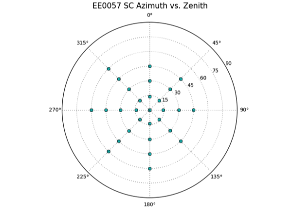
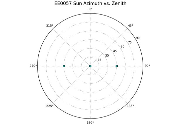
Viewing Conditions
Name |
Sun |
S/C Az |
S/C Zenith |
Total Number of Images |
Test11S |
45, 0, -45 |
every 45 |
0, 30, 60 |
80 |
Test11T |
45, 0, -45 |
every 45 |
0, 20, 40, 60 |
112 |
Test11U |
45, 0, -45 |
every 45 |
0, 15, 30, 45, 60 |
144 |
Note that a larger image suite was planned and produced than was utilized during test. The images for a number of planned viewing conditions were eliminated due to image quality related to the viewing conditions being unfit for SPC. For further details are contained here:
Test11STU Unsuitable Viewing Conditions.
Test11S Viewing Conditions
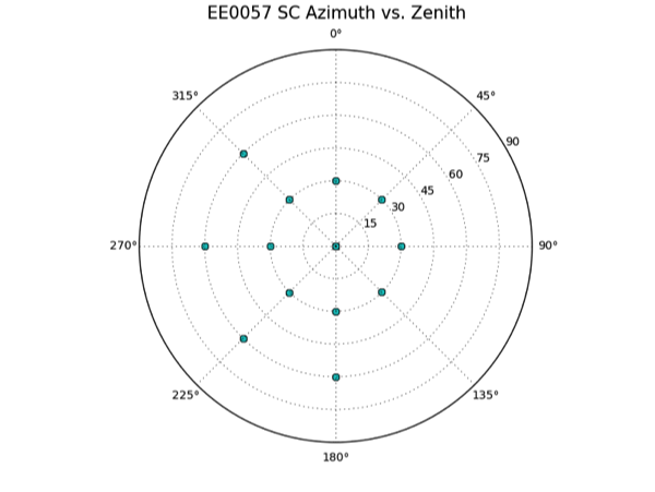
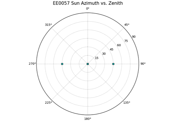
Test11T Viewing Conditions
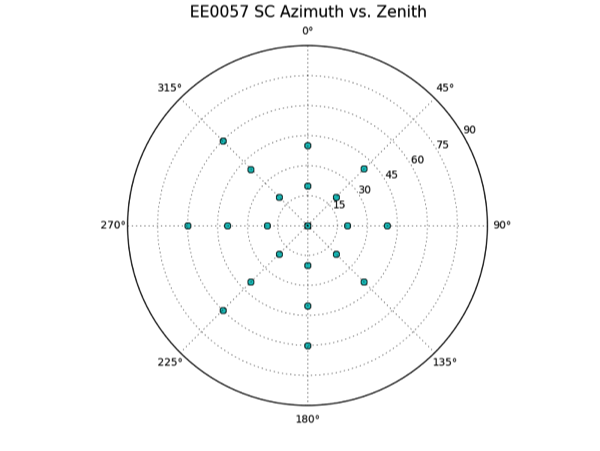
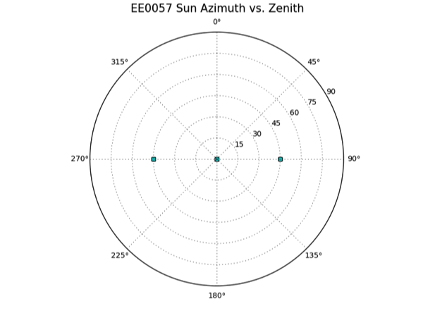
Test11U Viewing Conditions
Results
Results with Overlaps:
Test Over11STU Comparative Results
Results without Overlaps:
Discussion
From an inspection of the minimum formal uncertainty, CompMapVec RMS and CompareOBJ RMS (both the minimum value and the number of iterations at which the minimum occurs), for tests S, T and U, the following is apparent.
Within-measure range of minima |
||
Formal Uncertainty |
1.511 +/- 0.087 cm |
|
CompMapVec RMS |
0.875 +/- 0.325 cm |
|
CompareOBJ RMS |
0.938 +/- 0.097 cm |
|
CompareOBJ with Optimal Trans & Rot |
0.435 +/- 0.072 cm |
|
- All minima were below the image resolution (2cm).
- Formal uncertainty showed a negative trend which appeared to still be decreasing after 50 iterations.
The RMSs reached minima within the first 30 iterations and then diverged. No asymptotic behavior is clear, the RMSs appear to worsen as testing continues to 50 iterations and beyond, although RMSs remain below the image resolution in all cases except TestS's CompMapVec RMS.
