Stage 1 - Initial Load
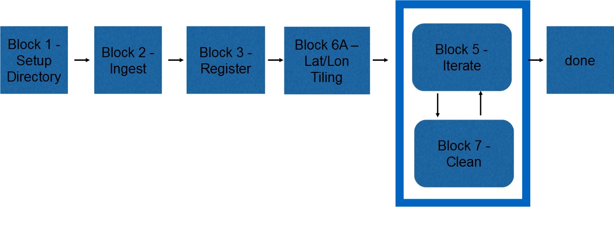
The first stage of building the shape model is to bring in the first set of images and generate landmarks from them. The following figure illustrates the general process of this stage.

Figure 00: Block Diagram for Startup
First, the images are imported into the SPC system and converted into the SPC internal format. Then the alignment of the images is improved. Next, a set of initial landmarks is generated with a GSD of 120cm at a spacing of 20 degrees. Batch processing then generates the topography and improves the landmark registration.
The following table details the blocks, the procedures and the programs used to accomplish this stage:
Table 00: Procedures for Initial Start
Block |
Procedure Name |
Executables |
Setup Directory |
|
|
Ingest |
||
Register |
||
Lat/Lon Tiling |
||
Iterate |
||
Clean |
Stage 2 - Adding Images
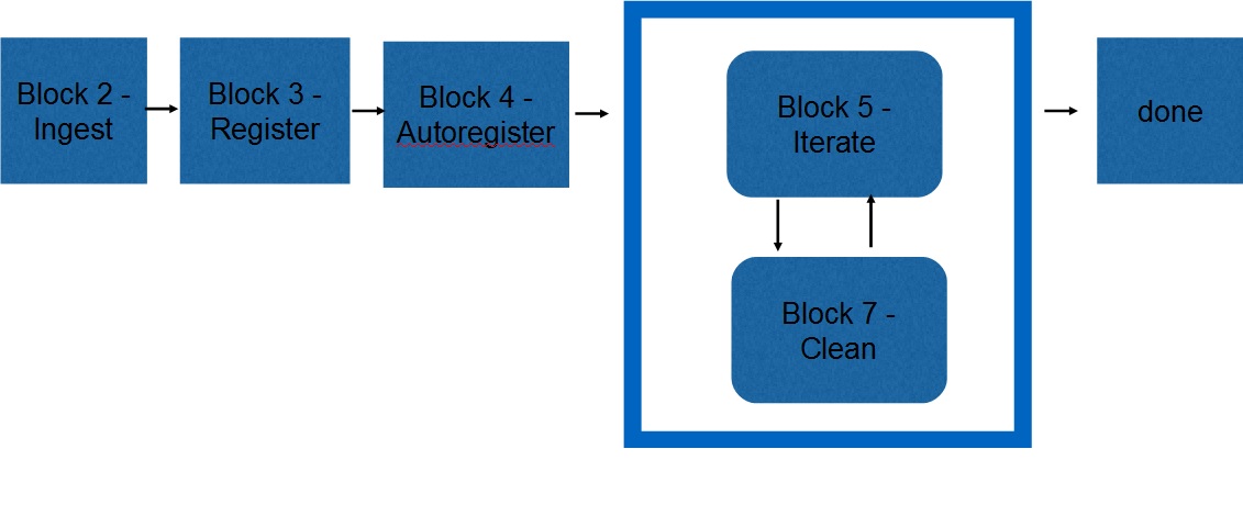
Most of the blocks in Stage 2 are similar to those in Stage 1. For those blocks, the commands will be the same. The major difference in Stage 2 is the use of autoregister. The following diagram shows the general process for Stage 2.

Figure 00: Block Diagram for Adding Images
Autoregister loads existing landmarks into a new image. When you give it an image, it locates all landmarks that fall within its boundaries. Then you can use auto-align (just as in LITHOS). You can also do auto-eliminate and set the star flag for building a template. This generates LMRK_DISPLAY1.pgm which shows pairs of landmarks for the image.
The following table shows the blocks, the procedures and the programs used to complete Stage 2:
Table 00: Procedures for Adding Images
Block |
Procedure Name |
Executable |
Ingest |
||
Register |
||
Autoregister |
||
Iterate |
||
Clean |
Once you have built the initial shape in Stage 1, it will replace the Nolan radar shape model stored in the SHAPEMODELS directory. This allows a more effective image projection and registration when ingesting new images.
Stage 3 - Increase Resolution
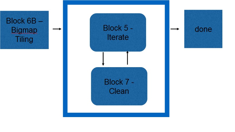
Here is an illustration of the general process of Stage 3.

Figure 00: Block Diagram for Generation of Subregion Maps
In Stage 3 you will use several automated processes to craft subregions using bigmap, tile that bigmap with higher resolution maplets and then process them until the topography becomes stable (i.e., does not change much between iterations). Bigmaps are flat maps of a section of the shape model. They allow you to focus on a specific section of the shape, which decreases the number of data files being processed. Bigmaps are also 2D rather than 3D, allowing for easier display and analysis than the full shape model.
The following table shows the blocks, the procedures and the programs used to complete Stage 3:
Table 00: Procedures for Subregion Map Creation
Block |
Procedure Name |
Executable |
Bigmap Tiling |
||
Iterate |
||
Clean |
The goal of stage 3 is to increase resolution, which requires creating numerous additional maplets. You do this by tiling a bigmap with more maplets. Typically, you define a region of the surface with a bigmap of 1000 x 1000 pixels (OSize = 500). The scripts then produce input files for lithos that create new maplets every 50, which generates about 360 new maplets. The resolution for the maplets is set to create at least 25-30% overlap.
You will iterate these products until the error among the maplets is low. Iteration consists of running Step 3-5 “Batch Topo” numerous times. Next, you will use the criteria in Step 3-6 “Evaluate” to indicate where there are problems with the shape model and what needs additional attention. When the residuals become small and the delta correction in the topography becomes small, or if met the navigation requirement, you will output the complete model. Maplets that have problems will go through Stage 4 - Problems.