Test 11: ReferencePeaks
Take PIT020 as the only maplet in MAPLIST.TXT. Generate 5cm images of the topography (which is based at TAG Site 1). Then we build a MAPLET, saving the MAPLETs flatMapVect at several states.
Simple Variations
Groups of images - (adjusted for 5cm)
- Test11A - Detailed Survey. Eric (Has 11 images, very low in sample space)
- Test11B - Min Orbit B (by hand, calculate the minimum requirement)
- Test11C - Average Orbit B (use a random Orbit B solution with 3 unique observation/illumination conditions)
- Test11D - Best Orbit B (as we did before)
- Test11E - Optimum Collection (as we did before)
Name |
Sun Az |
Sun Zenith |
S/C Az |
S/C Zenith |
Optimum Collection1 |
0, 90, 180, 270 |
45 |
every 20 |
45 |
Optimum Collection2 |
135 |
30 |
every 20 |
45 |
- Test11U - Criss Cross (combine both of these sets)
Name |
Sun |
S/C Az |
S/C Zenith |
Criss Cross 1 |
80, 60, 40, 20, 0, -20, -40, -60, -80 |
45 |
45 |
Criss Cross 2 |
45 |
0, 180 |
80, 60, 40, 20, 0 |
Variations
Spacecraft Azimuth Variations
Name |
Sun |
S/C Az |
S/C Zenith |
Who |
RMS w/trans |
45, 0, -45 |
every 20 |
45 |
Diane |
Test11F=0.77cm |
|
45, 0, -45 |
every 30 |
45 |
Diane |
0.83cm |
|
45, 0, -45 |
every 45 |
45 |
Tanner |
||
45, 0, -45 |
every 60 |
45 |
Kris |
1.21cm |
|
45, 0, -45 |
every 90 |
45 |
John |
2.52cm |
Sun Variations
Name |
Sun |
S/C Az |
S/C Zenith |
Who |
RMS w/trans |
30 |
every 45 |
45 |
Diane |
3.61cm |
|
30 -30 |
every 45 |
45 |
Tanner |
||
-45, -45 |
every 45 |
45 |
Kris |
||
30, 0, -30 |
every 45 |
45 |
John |
||
45, 30, 0, -30, -45 |
every 45 |
45 |
Diane |
0.71cm |
|
60, 45, 30, 0, -30, -45, -60 |
every 45 |
45 |
Tanner |
||
60, 30, -30, -60 |
every 45 |
45 |
Kris |
(eep 0.62cm) |
Spacecraft Zenith Variations
Name |
Sun |
S/C Az |
S/C Zenith |
Who |
RMS w/trans |
45, 0, -45 |
every 45 |
0, 30, 60 |
John |
||
45, 0, -45 |
every 45 |
0, 20, 40, 60, 80 |
Tanner |
||
45, 0, -45 |
every 45 |
0, 14, 30, 45, 60, 75 |
Diane |
1.02cm |
Hill Data
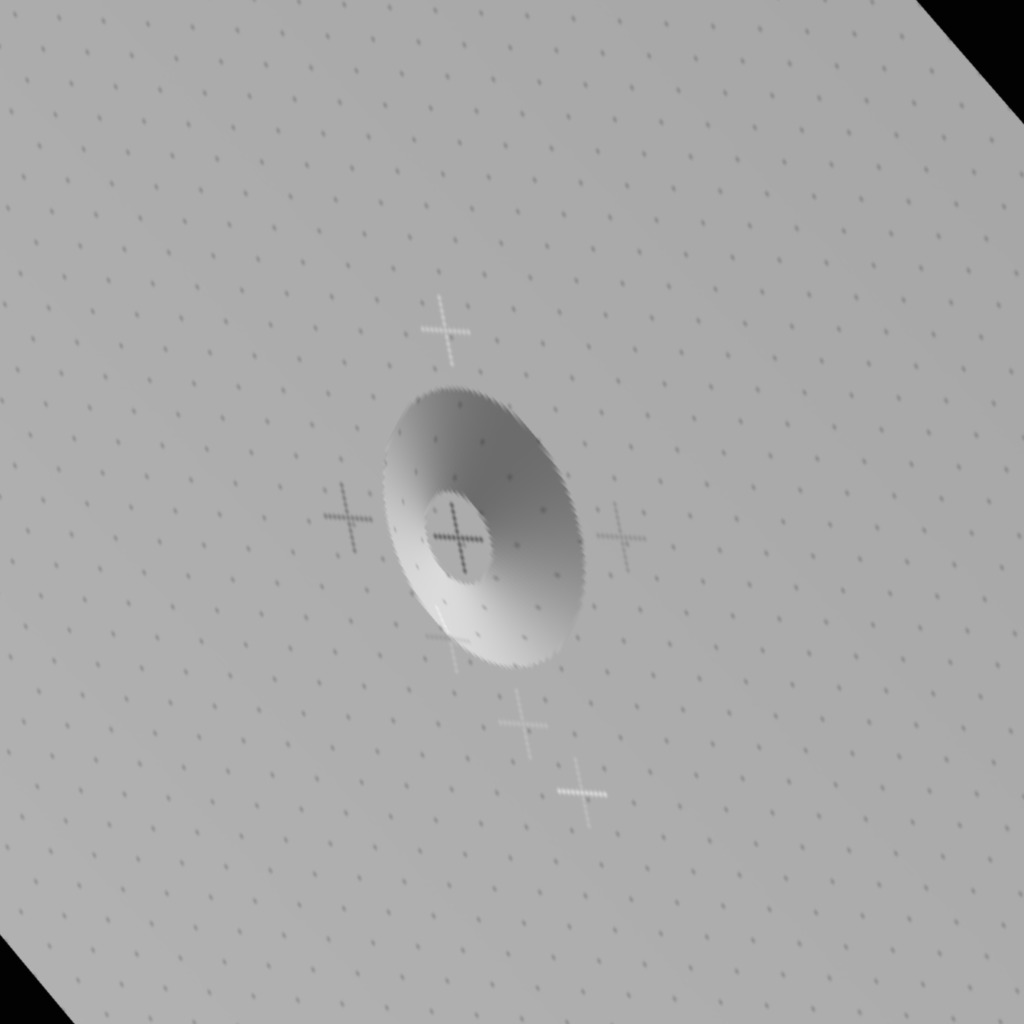
I have created the following hills for testing
- PIT007 - 7 deg tilt
- PIT014 - 14 deg tilt
PIT020 - 20 deg tilt <-- Let's use this one
- PIT030 - 30 deg tilt
- PIT045 - 45 deg tilt
- PIT060 - 60 deg tilt
Truth Maplets
- -8.027 262.768
- T11TRU.MAP - already built. It has the truth heights loaded from PIT020.
- T11TRU.TXT -- Text file of the maplet. Use for plotting transits
- t11-truth.obj -- OBJ file for testing using CompareOBJ
Testing Maplets
- -8.027 262.768
- Build a model MAPLET using TAG Site 1 center position (5cm resolution and Q=49). Do not load a base map for topography
- Create MOD20#, which # is the test number (letter)
- Align the images with the key location at 50/50.
- Build template with 100
- (Skip until close to perfect) -- Do an auto align
- Build height using the iteration template
- Do flatMapVec and rename it to mod-20#-1
- Do compMapVec between MOD20# and T11TRU
- Repeat as necessary
Iteration Template
0
0
44
2
8                fill no data with shape slope
7
.01
6
y
y
1                condition with overlapping maps
2                condition with existing topo
.01
6
y
y
0                begin integration
.025
100
0
v
1
u
1
o                overlaps
RECENT
n
1
i
r
n
n
Useful copy/paste stuff
echo CENTER | /usr/local/localBin/flatMapVec
 /usr/local/localBin/compMapVec MAPFILES/CENTER MAPFILES/T11TRU.MAP
~/eval/bin/Maplet2FITS MAPFILES/CENTER fit
 ~/eval/bin/FITS2OBJ --local fit center.obj
 ~/eval/bin/CompareOBJ    --compute-optimal-translation-and-rotation   center.obj newtru.obj
convert  LMRK_DISPLAY1.pgm display.jpg
mkdir step02
cp CENTER.TXT MAPFILES/CENTER.MAP step02

gnuplot
set term x11
set style data lines
plot 'NEW020.TXT' u 0:50 lw 3 lc 0, 'CENTER.TXT' u 0:50
set output 'out.png'
set term png
replot
unset output
set term x11
exit

mv out.png mod20f.obj MOD20F.TXT comp.txt display.jpg step2
Save States
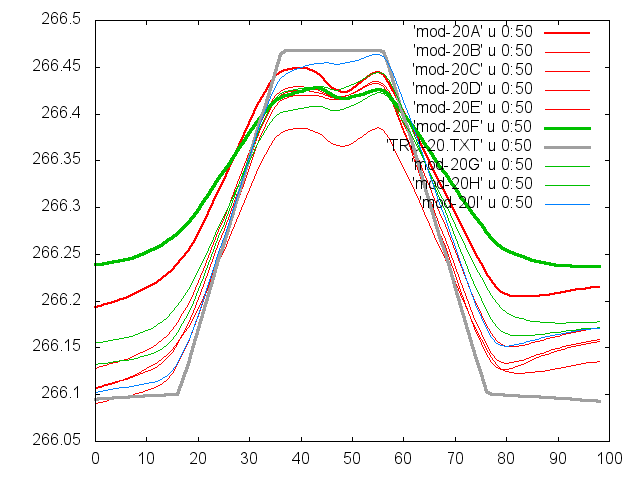
The goal is to see the evolution of the model over time. You can stop iterations once the peak and base are stable. The most likely tool to evaluate if the model has reached it best fit will be transit.
Save the flatMapVect statistics at the following number of iterations
- 1st
- 2nd
- 3rd
- 5th
- 10th
- 15th
- 20th
- 50th (if needed)
- 100th (if needed)
- 200th (if needed)
Examples

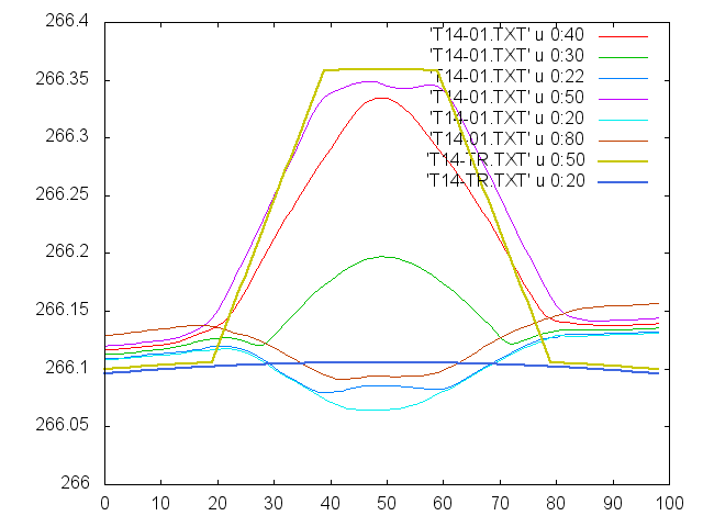
Example of a 14 degree peak, measured at difference locations 
Example of a 20 degree peak, measured over time 
